
Trace a Babylon Street Address
Begin with the original street address, including its postal city and ZIP. Confirm the delivery ZIP through the USPS ZIP Lookup, then use the Town assessor or the county map to identify the parcel. The property location is the situs address. It can differ from the owner's tax mailing address, so neither field alone establishes who currently lives there. Suffolk uses a district, section, block and lot, often called a DSBL, to keep a parcel distinct when a postal name, hamlet, or service district changes.
- Check the Town of Babylon Assessor links and the parcel map for the situs, assessment-roll entry, and parcel identifier. Save the address spelling and the date of the roll.
- Use the GIS parcel geometry to keep the street segment and surrounding lots straight. Record the tax-map identifier rather than relying only on a street label.
- Search that identifier, or the house number, street name, and ZIP, in the Suffolk County Clerk Search Records portal. Read the most recent grantee deed and then work backward through prior grantors when a historical title trail is needed.
- Use the NYS Voter Lookup only for a specific, lawfully researched individual. It asks for identifying fields and is not a street roster or a way to assemble a household list.
- For a dated occupancy lead, ask Babylon Public Library or the Town Historian about historical telephone and address-directory material. The research did not confirm a complete Babylon criss-cross run, so a missing volume is not proof of a missing household.
The chain is deliberately narrow: address to parcel, parcel to recorded document, then a dated historical source if needed. It avoids turning a public map or an owner field into a claim about a private household.
Babylon Street Map Layers
The Suffolk County GIS Viewer is the best street-by-street starting map. Its service lists tax parcels, tax parcel owners, street labels, ZIP codes, districts, roads, building footprints, and environmental and reference layers. Use a road label and parcel outline to orient the search, then confirm a legal boundary with a tax map, deed, or survey. Suffolk labels the map service as reference material and warns that accuracy is not guaranteed.
The GIS method is spatial. Browse the extent, identify a parcel, note its parcel ID, then inspect adjoining outlines and road edges. The owner layer can offer a lead, but it can lag the recorded deed, contain a tax-mailing name, or represent an entity. The service supports identify, find, query, pagination, statistics, and exports, with a 2,000-record and selection cap. A broad result at that cap is a reason to narrow the map, not a complete street result.
The Suffolk GIS service displays the public layer structure used for Babylon street-directory research.
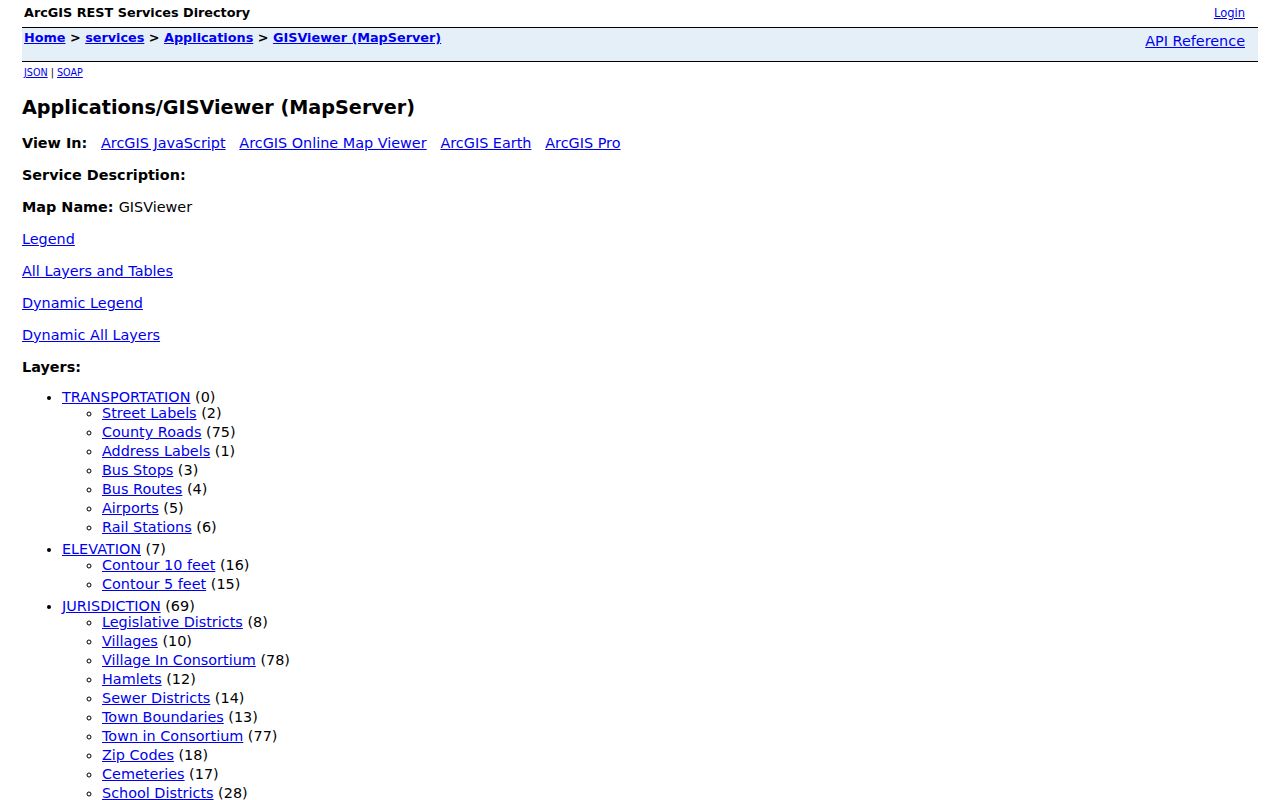
Parcel, road, ZIP, and district layers should be read together, while each retains its own purpose and date.
Note: A school, fire, or ZIP layer can describe service geography without defining a parcel's legal municipal boundary.
Babylon's 2,000-Result Street Search
The Suffolk County Clerk and GIS services each impose a 2,000-result boundary in the documented research. On the Clerk portal, only the first 2,000 records display. The GIS service reports the same maximum for records and selections. That number is a search limit, not a count of every document, parcel, or person associated with a street.
Narrow the question before treating a screen as complete. An exact tax-map ID, house number and street name, date range, match preference, and a smaller map extent all reduce ambiguity. Retain the search date and terms in a log, especially when a parcel has a common owner name, a changed address, or a condominium identifier.
Babylon Parcel Keys by Street
A parcel key gives the address trail a stable record handle. Suffolk's Tax Map Division identifies parcels by district, section, block, and lot. Retain zero padding when it appears in a result. The official example is district 0200, section 001.00, block 01.00, lot 001.000. Condominiums require special care: the County Clerk instructions say the exact tax-map number is required, so an empty street-address search is not evidence that no record exists.
| GIS field or control | Use in a Babylon address search |
|---|---|
| Map extent or geometry | Browse or query the area around the supplied address. |
| Layer selector | Choose tax parcels, tax parcel owners, street labels, ZIP codes, or districts for the specific question. |
| Parcel ID | Carry this parcel-linked identifier into the assessor and Clerk research trail. |
| Owner Name | Treat the GIS owner field as a lead that needs deed and assessment confirmation. |
| Query and pagination | Narrow an area or layer before the 2,000-result service limit is reached. |
Assessor search controls were not fully visible in the official research environment. The official Assessor page confirms property-card and roll functions, but it does not support guessing at an owner-name or ZIP filter. For a card or older file, use the Assessor's stated route or a focused Town FOIL request.
Babylon Deeds by Street
Recorded land documents supply a document trail, not a resident roll. The Clerk's address and tax-map search accepts house number, street name, and ZIP for tax-map lookup, as well as an exact property tax-map ID. A name search can be narrowed by date and match preference. Deed results identify such things as liber, page, document type, grantee, grantor, date received, and image or copy options. Mortgages use mortgagee and mortgagor fields instead.
Start with the most recent deed identified by the parcel key. The grantee on that deed becomes a historical search term, while the prior grantor can supply the next step backward. Check later releases, satisfactions, mergers, subdivisions, and condominium records before drawing a conclusion. The Clerk's online land-record imaging context is 1987 to present; older material may require the Clerk, FamilySearch, a library repository, or index books. Basic searching, document images, and certified copies do not carry the same access terms.
The Suffolk County Clerk address and tax-map search shows the address fields and current service notice used in Babylon address research.
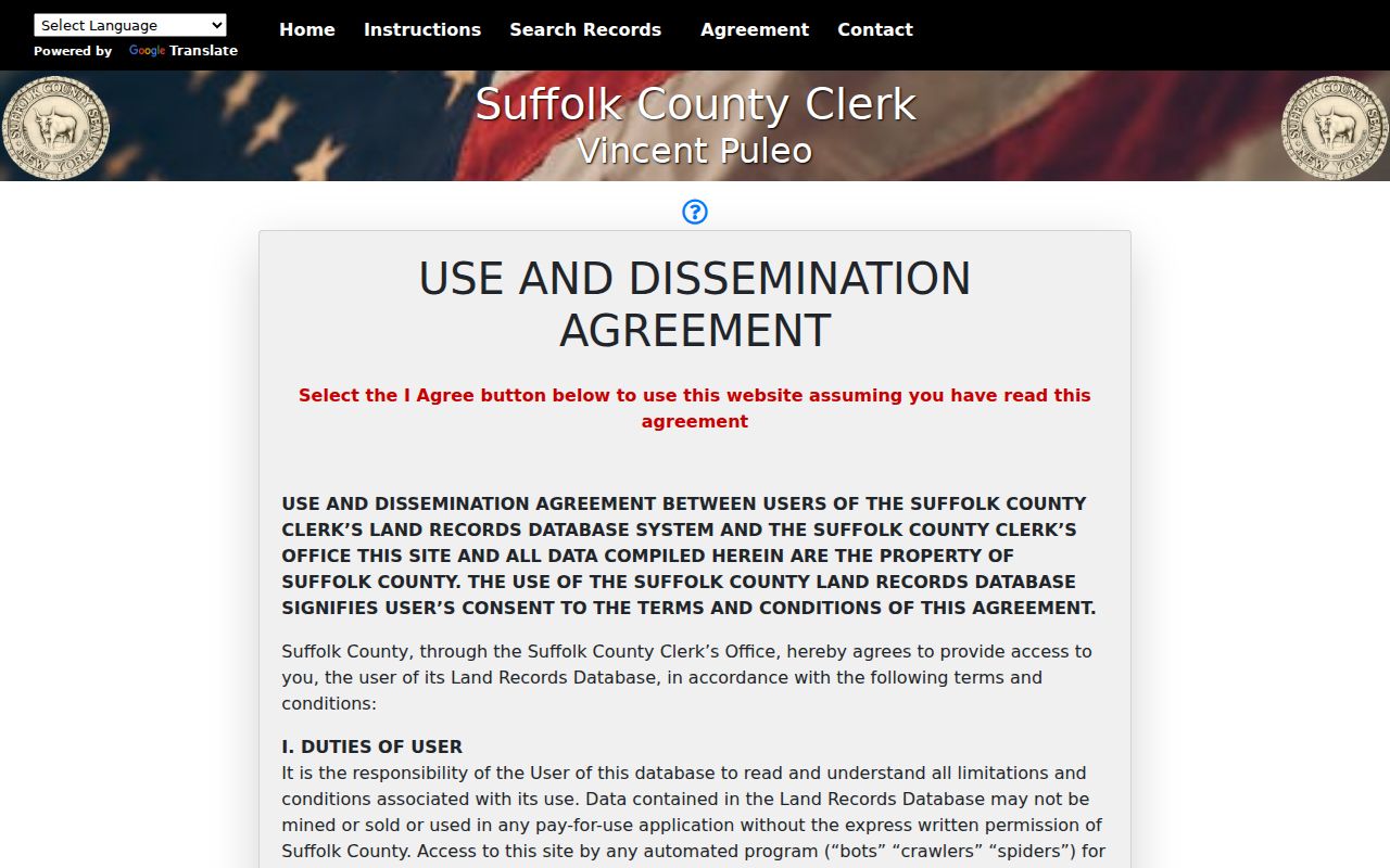
A tax-map result narrows a legal-record search; it does not establish current occupancy or household relationships.
Babylon Street Permit Trails
Address-keyed municipal files can explain changes to a place without naming every person connected to it. The Town's Building, Planning, and ZBA applications and supporting material moved to the OpenGov Online Permit Center on February 2, 2026. The system supports applications, tracking, and payment. A pre-transition file may be in a legacy system, a paper file, or a migrated account, so ask the department which system controls the date and permit type.
Building, Planning, and Town FOIL materials identify record families such as permits, certificates of occupancy, surveys, site plans, variances, code files, and environmental records. A permit category only shows what the office may hold. It does not prove that work occurred at a particular address. Capture the permit number, date, status, parcel, and publicly visible approval or inspection event rather than making a broad request for every record tied to a street.
Note: A narrowly described existing-record request is more workable than a request asking the Town to create a street-wide report.
Babylon Street History Sources
Older street work needs a time layer. The Town's March 2026 Local History Sources Guide identifies newspapers, atlases, Sanborn maps, aerial imagery, and repositories that can bridge an older address to a current map. The research did not locate an official Town-wide street-renumbering or renaming chronology. Compare the address spelling in an old deed, map, newspaper, and directory section rather than silently substituting a modern label.
Sanborn maps show a structure's footprint, construction details, and map date, but generally not its owner or occupant. The Town guide lists Babylon village Sanborn dates from 1885 through 1943 and documents other community runs. Atlases can help with road and parcel context, but the guide warns that the c.1929 Dolph & Stewart atlas has limited owner and structure detail. For longer historical work, the Babylon city directory collections provide the shelf-and-source context without treating a dated line as proof of current residence.
Babylon Street Service Labels
One Babylon address may carry more than one truthful label. A postal city is assigned for mail delivery, while a parcel has a situs, a tax-map location, and possible hamlet, village, school, library, fire, and election-district labels. The Town explains this overlap through examples involving West Babylon, Wyandanch, Wheatley Heights, and North Lindenhurst. Keep the source label beside the source that produced it instead of forcing every result into one neighborhood name.
The Town Assessor works with USPS on house numbers, Suffolk GIS and RPTSA map parcels, the Clerk indexes legal instruments, and USPS routes delivery. A mailing address can be different from a property address. These differences are routine administrative distinctions, not proof that an official source is wrong. Use the original address, a normalized street form, ZIP, postal city, municipality, hamlet or village, DSBL, source, and retrieval date in a careful address log.
Babylon Address Record Coverage
Each address record answers a narrow question. The Assessor works from assessment administration, GIS supplies parcel-linked geographic leads, and the Clerk keeps recorded instruments. The voter service is deliberately different: New York's form is a specific-person lookup and does not offer a browsable street list. The Town's FOIL route is the fallback for specifically described existing municipal records that are not online.
| Babylon address source | Custodian | Useful fields or evidence | Access channel |
|---|---|---|---|
| Assessment roll and property card | Town of Babylon Assessor | Situs, tax owner field, mailing address, assessment, exemption, building and permit clues | Roll links, property route, or focused FOIL/card request where needed |
| Tax map and parcel layer | Suffolk RPTSA and GIS | DSBL, parcel geometry, adjacent parcels, roads, districts, and map context | Public viewer, map service, or office verification |
| Deed, mortgage, lien, or map | Suffolk County Clerk | Grantor, grantee, instrument, recording date, liber, page, and linked documents | Online index; image, copy, mail, office, or enhanced-access route as applicable |
| Permit, CO, or planning file | Town Building and Planning | Permit type, application, status, inspections, plans, or variance history when public | OpenGov, department contact, or FOIL |
| Voter registration response | NYS and Suffolk Board of Elections | Individual registration or poll-site response subject to statutory limits | Specific-person lookup or lawful request, never street browsing |
When a source conflicts, do not select a convenient “master” owner. Compare the roll date, recorded date, map update, and mailing or situs fields. The Clerk and GIS each display only the first 2,000 results, so date, location, and exact matching controls are essential for a defensible street search.
Babylon Address Record Terms
Short records terms prevent a street search from overreaching. These labels describe record functions, not people's relationships to an address.
- Parcel
- A mapped unit of land used for tax and assessment administration. Its boundary or number can change after a subdivision, assembly, or condominium action.
- Situs address
- The physical location of the parcel. It is distinct from the mailing address used for tax correspondence.
- Plat or tax map
- A map record used to identify land. Suffolk's Tax Map Division is the authority for parcel identification, while a survey or deed controls different legal questions.
- Criss-cross directory
- A historical directory arranged by address rather than only by name. A local Babylon run must be confirmed with the holding institution before relying on it.
Limits on Babylon Street Records
Street records cannot show every household member, utility customer, delivery recipient, or DMV address. A tax mailing address is not a current-residence finding. A voter lookup is not a street roster, and New York law limits voter-file use. Protected addresses, sealed records, minors' records, sensitive files, and New York's Address Confidentiality Program require special care. If a field is withheld, do not infer the missing fact from a map or another record.
Lawful use. Babylon address records support personal, civic, and historical research when handled with care. Do not use them to stalk, harass, intimidate, dox, or try to identify a protected person.
For records not exposed online, submit a focused request through the Town of Babylon FOIL form. New York Freedom of Information Law (FOIL), Public Officers Law Article 6, §§84–90, concerns existing reasonably described agency records. The Town says it acknowledges requests within five business days and may give notice when more time is needed.